

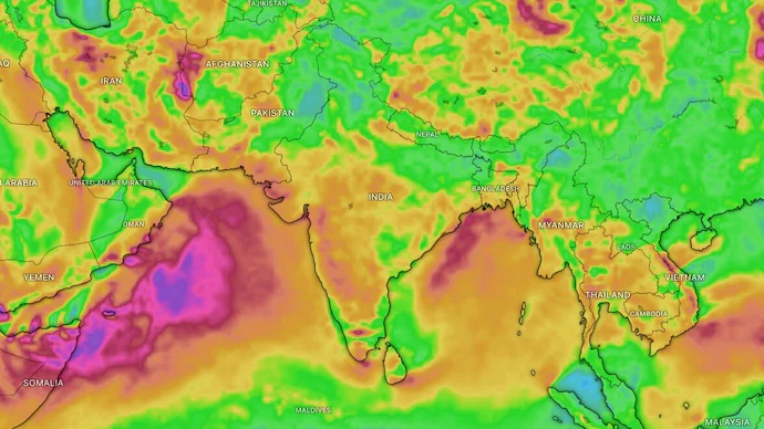
India’s southwest monsoon has weakened significantly, with the country’s rainfall deficit widening to 24% between June 1 and July 16, 2026. The shortfall has already exceeded the overall seasonal deficit recorded during the severe 2002 drought year, raising fresh concerns for agriculture, water resources, and the months ahead.
Although the monsoon covered the entire country in early July, rainfall activity slowed sharply afterward, leaving several regions much drier than normal.
Rainfall Remains Well Below Normal
Latest weather data shows India received 224.8 mm of rainfall against a normal 295.8 mm during the period from June 1 to July 16.
The “normal” rainfall is based on the Long Period Average (LPA), which represents the average rainfall recorded across the country between 1971 and 2020.
A rainfall deficit of 24% at this stage of the season is considered significant because it has already surpassed the 19% seasonal shortfall recorded during the 2002 drought year. However, the comparison is not exact, as the current monsoon season still has several weeks remaining and rainfall through September could reduce the overall deficit.
Which Regions Are Most Affected?
The rainfall shortage has not been evenly distributed across the country.
Current regional deficits include:
- East and Northeast India: 36% below normal
- Southern Peninsula: 26% below normal
- Northwest India: 19% below normal
- Central India: 13% below normal
The week between July 9 and July 15 was particularly dry, recording rainfall about 51% below normal, following one of the driest Junes in more than a century.
Why Is the Monsoon Weak This Year?
Meteorologists point to several large-scale weather systems influencing this year’s monsoon.
El Niño Remains the Biggest Factor
The primary reason is the development of El Niño, a climate pattern caused by unusually warm sea surface temperatures in the central and eastern Pacific Ocean.
El Niño often weakens the moisture-carrying winds that feed India’s southwest monsoon, reducing rainfall over large parts of the country. Similar conditions also played a major role during the severe drought experienced in 2002.
Neutral Indian Ocean Dipole Offers Little Support
Another climate pattern, the Indian Ocean Dipole (IOD), can sometimes strengthen India’s monsoon when it enters a positive phase.
However, the IOD is currently in a neutral state, meaning it is not providing additional support to offset the impact of El Niño.
Madden-Julian Oscillation Not Favourable
The Madden-Julian Oscillation (MJO), a moving system of clouds and rainfall that travels around the tropics, is also not positioned in a way that would encourage widespread rainfall over India at present.
Rain Expected Only in Some Regions
The weather outlook suggests that rainfall will continue to remain uneven over the coming week.
Enhanced rainfall is expected across:
- East India
- Northeast India
- Eastern Uttar Pradesh
- Western Himalayan region, including Uttarakhand
- Parts of Punjab
Meanwhile, much of west-central India and the southern peninsula are expected to experience relatively dry conditions.
Weather officials also expect the overall rainfall for July to remain below 94% of the Long Period Average.
Is India Heading Towards a Drought?
At present, India has not officially entered meteorological drought conditions.
A meteorological drought is generally declared only when seasonal rainfall falls below 75% of the Long Period Average over a region.
However, the current rainfall deficit is already creating challenges for:
- Kharif crop sowing, including rice, cotton, and pulses
- Reservoir storage levels
- Groundwater recharge
- Water availability during the coming months
If rainfall continues to remain below normal through the rest of the season, experts believe 2026 could become one of the weakest monsoon years in recent decades.
Impact on Agriculture and Water Resources
The southwest monsoon supplies nearly three-fourths of India’s annual rainfall and plays a critical role in agriculture and drinking water supplies.
Lower rainfall can delay crop growth, reduce agricultural productivity, and affect reservoir levels needed for irrigation and domestic consumption. Farmers in rain-fed regions remain particularly vulnerable if the rainfall deficit continues through August and September.
What to Watch Next
The next few weeks will be crucial for the 2026 monsoon season. While rainfall is expected in parts of eastern and northeastern India, many regions continue to wait for sustained showers.
Weather patterns such as El Niño, the Indian Ocean Dipole, and the Madden-Julian Oscillation will continue to influence rainfall during the remainder of the season. Their development will determine whether the current deficit narrows or deepens in the months ahead.
Frequently Asked Questions (FAQs)
1. What is India’s current monsoon rainfall deficit?
India has recorded a 24% rainfall deficit between June 1 and July 16, 2026.
2. Why is the monsoon weaker this year?
The main reason is the influence of El Niño, along with a neutral Indian Ocean Dipole and an unfavourable Madden-Julian Oscillation.
3. Is the 2026 monsoon worse than the 2002 drought?
The current mid-season deficit is larger than the full-season deficit recorded in 2002, but the monsoon season is still ongoing and rainfall through September could improve the situation.
4. Which parts of India have the biggest rainfall shortage?
East and Northeast India currently have the largest rainfall deficit at 36% below normal.
5. Will rainfall improve in the coming days?
Rain is expected in eastern, northeastern, and parts of northern India, while many western and southern regions are likely to remain relatively dry.
6. What is El Niño?
El Niño is a climate pattern involving warmer-than-normal Pacific Ocean temperatures that often reduce India’s monsoon rainfall.
7. Has India officially entered drought conditions?
No. India has not yet met the criteria for a meteorological drought.
8. How does weak monsoon affect farmers?
Reduced rainfall can delay sowing, lower crop yields, and increase irrigation challenges for kharif crops.
9. What is the Long Period Average (LPA)?
The Long Period Average is the average rainfall recorded between 1971 and 2020, used as the benchmark for measuring monsoon performance.
10. Why is the monsoon important for India?
The southwest monsoon supports agriculture, replenishes reservoirs, recharges groundwater, and provides most of India’s annual rainfall, making it essential for the country’s economy and food security.
Leave a Reply