



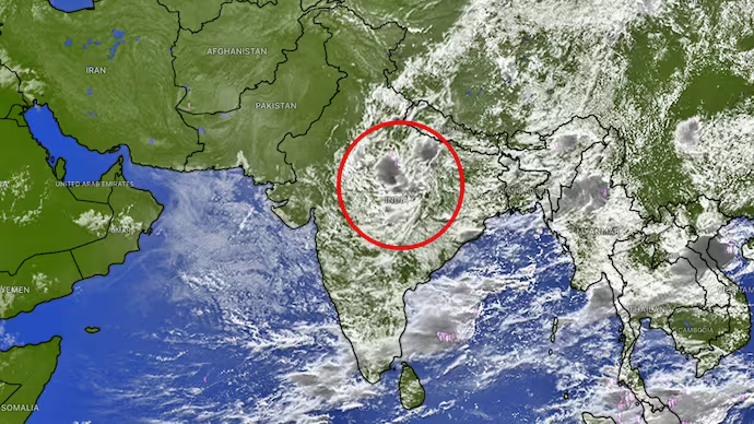
Thermal infrared satellite imagery from the INSAT-3DS platform has captured a broad build-up of monsoon clouds across central and eastern India, signaling a major fresh spell of precipitation. Dense convective cloud structures indicate atmospheric instability capable of generating intense localized showers, thunderstorms, and sustained rainy conditions across several regions.
The satellite observations highlight an increasingly uneven spatial distribution of active weather systems across the country. Extensive cloud cover stretches across the Indo-Gangetic plains, Bihar, Jharkhand, West Bengal, the northeastern states, and parts of Madhya Pradesh. Meteorological models indicate that East and Central India will remain the focal points for active monsoon conditions through early September, driven by lingering low-pressure systems and moisture-laden easterly winds.
Conversely, Northwest India, the western coastal belt, and substantial portions of Peninsular India are projected to experience relatively drier weather over the same timeframe. For the National Capital Region (Delhi-NCR), daytime convective development is expected to yield scattered, highly localized rain spells and late-afternoon thunderstorms. While certain pockets within the urban corridor may encounter sudden heavy downpours, adjacent areas are anticipated to stay predominantly dry.
Leave a Reply