Monsoon Retreat 2026: Satellite Images Show Clear Skies Over India
Satellite images show expanding cloud-free areas across northwest and central India as the southwest monsoon continues its withdrawal. However, rain activity persists in parts of eastern and southern India.
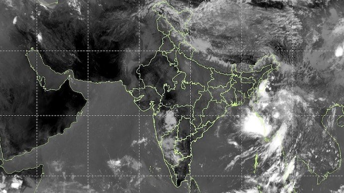
The southwest monsoon is gradually withdrawing from India, with satellite images showing increasingly clear skies across parts of northwest and central India. The changing cloud cover marks the transition from the rainy season towards a drier post-monsoon phase.
The India Meteorological Department said the withdrawal line currently extends through parts of Punjab, Chandigarh, Uttar Pradesh, Rajasthan and Gujarat before reaching the Arabian Sea. The monsoon began retreating from west Rajasthan around September 19 and withdrew from Delhi on September 23, slightly earlier than the usual September 25 date.
However, the disappearance of clouds alone does not mean the monsoon has ended everywhere. The IMD considers factors including sustained reduction in rainfall, changes in lower-level winds and falling atmospheric moisture while determining withdrawal.
Satellite imagery shows significantly less widespread cloud cover over northwest India, while cloud activity continues across parts of eastern and southern regions. The transition is therefore happening at different speeds across the country.
The IMD has indicated relatively calm conditions for Haryana, Chandigarh and Delhi through October 4, with no weather warning issued for these areas during the period.
Complete withdrawal from the entire country is a longer process and depends on the continued movement of the withdrawal line, declining moisture and persistent dry conditions.
So, while northwest India may be looking increasingly like the monsoon has packed its bags, the rainy season is not quite finished across the country yet.